- Call Us Now : +91 933-658-5266
- Send Us Email : geovisioninfocom@gmail.com

Auto Level Surveying
Auto Level Surveying
Overview
Auto level surveys are commonly used to complete cross-sectional and longitudinal surveys. This method requires a minimum of two field personnel. It is recommended that a basemap be generated to indicate locations of cross-sectional and longitudinal surveys. If no site elevation datum is available, it is recommended that a ‘project datum’ be established (it is general convention that these datums have a base value of +100) and clearly documented on the basemap.
Equipments
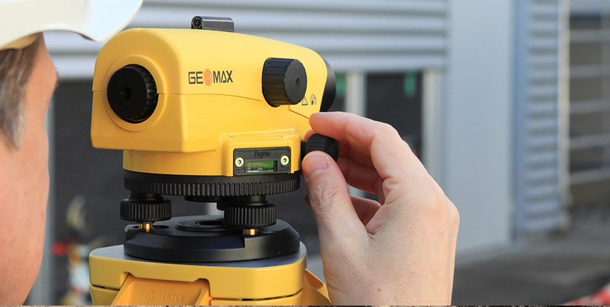
To complete your auto level survey, you will need the following minimum equipment:
- 1- Basemap
- 2- Auto level
- 3- Tripod (to mount the auto level)
- 4- Rod (required to measure ‘elevations’)
- 5- Tape measure (long tape measures, 100 or 300 feet, work best)
- 6- Clipboard and pencils, and
- 7- Digital camera (pictures can help you identify features within your cross-sections).
Be sure to fully inspect all of your field equipment prior to conducting your field work to ensure that all equipment is in proper working order. Repairing and/or replacing defective field equipment prior to venturing into the field will save you considerable time and heartache.